Geographic Reference

Milwaukee, Wisconsin

The largest city in the state of Wisconsin, Milwaukee is located in the southeastern corner of the state, on the shore of Lake Michigan. The region was inhabited by various Native peoples when French missionaries and fur traders arrived in the 1700s. A few European settlements were established along the banks of the Milwaukee, Kinnickinnic, and Menomonee rivers in the early 1800s, providing a base for the development of the city of Milwaukee, which grew as a trading and manufacturing center. Today, the city is known for its diverse industry, its large Lake Michigan port, and its progressive politics.

San Mateo, New Mexico

A small village located in central New Mexico, just northeast of Grants, about 100 miles west of Albuquerque. Prior to becoming known as the "Uranium Capital of the World" during the second half of the twentieth century, San Mateo was a small Hispanic village located near the western flanks of Mt. Taylor. Settled during the sixteenth century, San Mateo became a religious center for the remote and sparsely-settled area. Members of the Penitente Brotherhood practiced in San Mateo, as evinced by the small morada (temple of worship), located near the town. San Mateo lies in the heart of the Grants mineral belt, an expanse of land extending west from Albuquerque toward the New Mexico-Arizona border, where extensive uranium mining was in operation from the early 1950s to the late 1990s.

Denver, Colorado

The "mile-high" capital and largest city in Colorado, Denver is located at the western end of the Great Plains, just east of the Rocky Mountains. Arapaho peoples inhabited the area until 1858, when the gold rush brought white settlers to the junction of Cherry Creek and the South Platte River, where the site of the future city was established. Denver was named after James W. Denver, the Kansas territorial governor at the time. In the 1860s, uprisings by Cheyenne and Arapaho tribes provoked the forced removal of Native Americans from the state of Colorado. The city's settler population grew steadily after the arrival of the railroad in the 1880s, with gold and silver mining, as well as farming and ranching, sustaining its economy.

Denver saw a few economic booms in the second half of the 20th century, with the development of the Cold War military industry in the 1950s, oil production in the 1970s, and tourism in the 1990s. Today, the city is a hub of high-tech industry and commerce. Its scenery, proximity to mountain parks and ski resorts, and relatively mild climate attract many tourists and outdoors enthusiasts.

Idaho

A U.S. state located in the northwestern region of the country. Idaho is bordered by Oregon and Washington to the west, Utah and Nevada to the South, Montana and Wyoming to the east, and the Canadian province of British Columbia to the north. The Rocky Mountains and many large rivers, lakes, and falls make Idaho a scenic state with a diverse climate. Before the arrival of European settlers in the 19th century, the state was occupied by the Nez Percé, Coeur d'Alène, and Shoshone Native Americans, among others, and evidence of human presence in the area goes back at least 14,500 years. French-Canadian trappers and American explorers passed through the region, and non-indigenous permanent settlements and military posts were established in the second half of the 1800s, with fur trade and mining operations providing a basis for commerce and industry. When Idaho gained its statehood in 1890 its economy shifted toward agriculture and timber, as well as tourism. Idaho is known as the "Gem State," due to the variety of gemstones that are abundant in the area including garnet, opal, jade, and agate. It is also often referred to as the "Potato State" since potatoes are one of the state's most popular crops.

Interstate 25, Colorado, New Mexico and Wyoming

A major U.S. highway that runs mostly north-south, following the Front Range of the Rocky Mountains and crossing Wyoming, Colorado, and New Mexico. Part of the National Highway System that was authorized by the Federal Highway Act of 1956 under Dwight D. Eisenhower, Interstate 25 replaced several older roads and freeways. Its construction was intended to create a faster, easier connecting route between main cities in the three states including Cheyenne, Denver, and Albuquerque. In New Mexico, the route of the highway runs roughly along El Camino Real, the historic northbound road established by the Spanish in the 1600s, which in fact followed a long-existing trail used by the indigenous peoples of the area.

Dallas, Texas

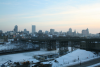
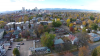
The third largest city in Texas (after Houston and San Antonio). Dallas is located in the northeastern part of the state in a flat, hot, and humid subtropical region. The area was originally inhabited by various indigenous peoples, and in the 18th century, with the arrival of the Spanish colonists, the territory was declared to be part of New Spain. The 1819 Adams-Onís Treaty opened the region to American settlers and much historical analyses points to the region's intrepid settlement by Anglo-Americans as provocation for the 1846 U.S.-Mexico War and the resulting 1848 Treaty of Guadalupe Hidalgo, in which the U.S. acquired more than half of Mexico's territorial land base, including northeast Texas.

Dallas was founded in 1844 as a small village of farmers and craftsmen. After the arrival of the railroad in the 1880s, the town grew steadily, becoming a major center for commerce in the Southwest. Over time, the cotton, oil, aircraft, automobile, and high-tech industries were the main contributors to the city's development and thriving economy. The city made international news on November 22, 1963, when President John F. Kennedy was shot, and killed, by Lee Harvey Oswald while his motorcade was passing through the downtown area. Today, Dallas is one of the most populous and diverse metropolitan area in the U.S.

Valencia County, New Mexico

A county located in central New Mexico. The county used to cover a much larger area than it currently does, but after the creation of Cibola County in 1981 it lost about 80 percent of its territory. The county seat used to be housed in Grants, but after 1981 was moved to Los Lunas.

New Mexico

New Mexico has a long and storied history due to the rich presence of living indigenous traditions that stretch back before European contact; its history of settler colonialism, specifically Spanish, French, and Anglo; and its itinerant border with Mexico. In 1680, the cultural and religious differences between the tribes and the Spanish settlers resulted in the Great Pueblo Revolt of 1680, in which the usually peaceful Native Americans banded together and succeeded in pushing all the Spaniards out of their land. A decade later, the Spanish settlers regained control of the Pueblo peoples and their territory. The territory changed hands several times over the next three centuries as more people of Anglo-European descent moved out west to New Mexico due to the opening of the Santa Fe Trail and later the railroad. To this day, the white inhabitants of the area incorporate various Native and Hispanic and Mexican traditions and cultural elements into their every day lives and special customs, from architectural styles, seasonal and spiritual holidays, and cuisine.

Crownpoint, New Mexico

A small community on the Navajo Nation Reservation in central New Mexico, located about 30 miles northeast of Thoreau (pronounced "through"). In Navajo, the place is called Tʼiistsʼóóz Ńdeeshgizh, meaning "Slender Cottonwood Gap." The town was founded in 1909 as a government settlement around the Pueblo Bonito Indian School. In 1935, the Navajo Central Agency at Window Rock assumed jurisdiction over the community and in the late 1950s it became known as the Crownpoint Agency. The Navajo Institute of Technology, an Indian health service medical center, a Bureau of Indian Affairs boarding school, a Navajo police substation, and the monthly Navajo weavers’ rug auction are all located in the town.

San Diego, California

The second largest city in California after Los Angeles, San Diego is located at the southernmost tip of the state, on the coast of the Pacific Ocean and adjacent to the US-Mexico border. Before the arrival of the Spaniards in the 16th century, the region that is now Southern California was inhabited by a variety of indigenous peoples including the Kumeyaay, the Cahuilla, and the Cupeño. The area was first named San Miguel in 1542, but in 1602 was renamed after the Spanish monk San Diego de Alcalá de Henares. A military post and California missions were founded in San Diego in 1769, and the town grew slowly around them through the brief Mexican take-over in 1834, and the U.S. acquisition of the territory in 1846.

The city saw rapid growth in the early 1900s, when its agriculture-based economy took a significant industrial and commercial turn with the opening of the Panama Canal in 1914 and the building of aircraft plants and military complexes in the surrounding area. After World War II, the city's industry expanded further to include electronics and high tech, and both its population and land area nearly quadrupled. San Diego is known for its year-round mild climate, scenic beaches, and diverse culture. It is home to a few major universities and medical facilities, as well as famous tourist attractions such as the San Diego Zoo, Sea World, and the historic Old Town district.

Pages

Subscribe to RSS - Geographic Reference