Geographic Reference

Zuni Wash, Arizona and New Mexico

In Tony Hillerman's 1973 Navajo detective novel DANCE HALL OF THE DEAD, Zuni Wash is a reference to the mostly dry river bed of the Zuni River. The Zuni River and its dry river bed, or wash, run southwest from the Zuni Mountains and across the Zuni Reservation until they join with the Little Colorado River just northwest of St. John's, Arizona.

Zuni River, Arizona and New Mexico

A small and mostly ephemeral river flowing southwest from its headwaters near the continental divide, where it runs through the Zuni Mountains in western New Mexico, to meet the Little Colorado River in eastern Arizona. The river passes through the Zuni Reservation and for centuries has been central to the Zuni people’s way of life, which included cultivating corn, beans, and squash, and raising livestock.

Tennessee (state)

A state located in the upper part of the U.S. South. Tennessee stretches from the Appalachian Mountains in the east to the Mississippi River in the west, and its diverse geography includes mountain ranges as well as vast flat areas of fertile agricultural land surrounding the Tennessee River, which flows through the state from east to west. The area that is now Tennessee has been populated for many centuries by Native American peoples, namely the Cherokee and the Chickasaw. With the arrival of European settlers in the 1770s, the state’s demographics gradually changed, and today the population constitutes an overwhelming majority of white people. Because of limited natural resources, the economy of Tennessee, which developed around agriculture and forestry, later to be replaced with industry, has been lagging behind most other states in the union.

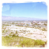
Tucson, Arizona

A large city located in the Sonoran desert of Southern Arizona, very close to the U.S.-Mexico border. The area on which the city is now built has been populated for many centuries by indigenous peoples, namely the Tohono O’odham and the Pima. With the arrival of the Spanish conquistadores in the late 1600s, a mission was built near the Santa Cruz River, and a settlement developed around it. The town grew as a center for commerce, and later on, in the late 1700s, as a strategic military fort in the battles between Spain and Mexico. With the American purchase of the Arizona territory in 1854, Tucson saw a significant growth, especially after the arrival of the railroad in 1880. The state of Arizona, however, was not officially annexed until 1912, and by then the city was well-established as a bilingual (Spanish and English), multicultural hub, serving its vast surrounding areas of small, rural communities. Tucson is home to a few general and specialized hospitals, a large airforce base, and the University of Arizona, which was founded in 1885 and remains a major center of cultural development and economic growth.

Oso Ridge, New Mexico

Part of the Zuni Mountain Range, Oso Ridge is located on the northeastern boundary of the Ramah Navajo Indian Reservation in Western New Mexico, about 30 miles southeast of Grants, and about half way between the El Malpais and El Morro National Monuments.

Route 504

In Tony Hillerman's 1984 Navajo detective novel THE GHOSTWAY, Jim Chee travels from east to west along Route 504, "through Teec Nos Pos, Red Mesa, Mexican Water, and Dennehotso." Currently, the route Chee followed aligns with U.S. Route 160, which extends between Tuba City, Arizona and Poplar Bluff, Missouri. In 1970, this route was bumped south from its original alignment in southern Colorado, absorbing numerous subsidiary Four Corners highways in the process. Today, Teec Nos Pos, Red Mesa, Mexican Water, and Dennehotso are all located along US Route 160, where it cuts across the Navajo Reservation as it travels through northeastern Arizona.

There is a an Indian Route 5043, which heads south from U.S. Route160 toward Pastora Peak, which lies several miles southwest of Teec Nos Pos.

Cottonwood Flats, Arizona

A colloquial reference to a grazing allotment near Chinle, Arizona, on the Navajo Reservation. Because of Chinle's proximity to Canyon de Chelly, a prominent system of canyons with enough water to support cottonwood stands, which is an anomaly in the red rock country of the Four Corners, many place names around Chinle are associated with cottonwoods.

Shiprock Sub-agency, Shiprock, New Mexico

The Navajo nation is split into seven districts, each with a field station. These stations include Window Rock, Arizona (1); Shiprock, New Mexico (2); Crownpoint, New Mexico (3); Tuba City, Arizona (4); Chinle, Arizona (5); Kayenta, Arizona (6); and Dilkon, Arizona (7). Each district is commanded by a Police Captain/Police Lieutenant, who ensures that the district is run properly and is in charge of the criminal investigations, patrol, and support. The Shiprock sub-agency is located in San Juan County, New Mexico. This sub-agency is one of the three locations in the Navajo Reservation with a correctional facility.

In Tony Hillerman’s novels Navajo detective novels, this sub-agency headed by Captain Largo and is Jim Chee’s headquarters.

Little Colorado River, Arizona

A tributary of the Colorado River, the Little Colorado is the main drainage pathway of the Painted Desert area in northeastern Arizona. The river flows northwest from Mount Baldy to the Grand Canyon, and while it stretches over about 300 miles, it is a dry wash for the majority of the year, except in times of heavy snow melts or flash flooding caused by extreme rain storms. Water does flow year-round through the lower parts of the Little Colorado River, which form a dramatic deep gorge that connects with the Grand Canyon.

Polacca Wash, Arizona

One of the major drainage pathways of the Black Mesa plateau, located on the Hopi Reservation in Northern Arizona. Black Mesa rises to about 7,000 feet above sea level, and tilts gradually downward to the southwest, where its four main washes form: Moenkopi, Dinnebito, Oraibi, and Polacca, each named after the Hopi communities that sit on top of the rims of the three “fingers” of Black Mesa that mark the Hopi homeland. Polacca Wash runs down the south side of First Mesa, the easternmost mesa.

Pages

Subscribe to RSS - Geographic Reference