Geographic Reference

Mishongnovi, Arizona

Also known as Second Mesa, and sometimes spelled Mishongovi, Mishongnovi is one of three villages located on Second Mesa within the network and community of the Hopi people spread out across the three mesas within Black Mesa in Arizona. The area of all three mesas makes up the Hopi reservation. Each of the mesas has its own cultural and spiritual significance to the Hopi people, and similarly, each village maintains its own traditions and rituals even while there is overlap among them. Mishongnovi is located on the eastern side of Second Mesa, which also includes the villages of Shipaulovi and Shongopovi. The Hopi word Mishongnovi means "Place of the Black Man" and may refer to the leader who brought the people to the villages in the thirteenth century. Ruins of previous village structures dating from the 13th century to the 1680s are located near the current village.

Bacavi, Arizona

Also spelled Bacobi and Bakabi, Bacavi is a village located on the east side of Third Mesa, within the larger network and community of the Hopi people spread out across the three mesas within Black Mesa in Arizona. The other villages on Third Mesa include Oraibi; New Oraibi (also known as Kyakotsmovi); Hotevilla; and Upper Moenkopi and Lower Moenkopi, both located a little bit outside of Third Mesa. Bacavi was founded in 1907, after a disagreement between factions of the Hopi people living in Oraibi, and is considered the newest of all the Hopi villages.

The area of all three mesas makes up the Hopi reservation. Each of the mesas has its own cultural and spiritual significance to the Hopi people, and similarly, each village maintains its own traditions and rituals even while there is overlap among them.

Walpi, Arizona

Walpi is one of three villages located on First Mesa within the larger network and community of the Hopi people spread out across the three mesas within Black Mesa, Arizona. In Hopi, the name means "place of the gap," which refers to a notch in the nearby mesa. It is the southernmost pueblo village on First Mesa, which also includes the villages of Sichomovi and Hano (or Tewa). The area of all three mesas makes up the Hopi reservation. Each of the mesas has its own cultural and spiritual significance to the Hopi people, and similarly, each village maintains its own traditions and rituals even while there is overlap among them.

Walpi was established in approximately 900 AD as the original, founding Hopi village. The inhabitants of the village still maintain traditional practices, for example living without electricity and running water. Following a 1680 revolt, the two other villages on First Mesa were established. Tourists can currently take walking tours of Walpi, since the Hopi have opened up their villages for visitors, after many years of resisting tourism.

Shipaulovi, Arizona

Also spelled Sipaulovi, Shipaulovi is one of three villages located on Second Mesa within the larger network and community of the Hopi people who are spread out across the three mesas within Black Mesa, Arizona. The area of all three mesas makes up the Hopi reservation. Each of the mesas has its own cultural and spiritual significance to the Hopi people, and similarly, each village maintains its own traditions and rituals even while there is overlap among them.

Shipaulovi is the northern most village on Second Mesa, which also includes the villages of Shongopovi and Mishongovi. Shipaulovi houses the Sipaulovi Hopi Information Center, which provides tours of the surrounding area. Otellie Pasivyaya Loloma, a famous Hopi potter, was born in this village.

Coconino County, Arizona

Located in northern Arizona, this county’s seat is in Flagstaff. The county encompasses Grand Canyon National Park as well as several Native reservations including parts of the Navajo Nation, the Hopi Nation, and the Hualapai Nation. The name Coconino comes from the Hopi word Cohonino, which refers to the Havasupai tribe.

There is evidence that thousands of years ago, nomadic peoples travelled up the Little Colorado River from the Great Plains into the Colorado Plateau area, which now makes up a large part of Coconino County. Currently, about 30% of the county's population is of Native American descent.

Keams Canyon, Arizona

Keams Canyon is a small community of about 300 people in a census designated area within the Hopi Reservation in Navajo County, Arizona. The name designates both the community as well as a nearby canyon, which features a channel that flows from Balakai Mesa to Polacca Wash. The location is named after the Keams brothers, who operated a trading post in the area in the late 1800s. It is called Lók'a'deeshjin in the Navajo language, which means "reeds extend in a black line." The Hopi call it Pongsikvi, which translates to "government community."

In the Dark Wind, Hillerman refers to this location as “Keans Canyon” and places the Joint Use Administration Office in the area, although it is actually located in Flagstaff, Arizona. However, the Hopi Indian Agency is located in Keams Canyon.

Sabinas Hidalgo, Nuevo Leon, Mexico

A small city founded in 1693 and located in the state of Nuevo Leon, in northeastern Mexico, near the border between Mexico and Texas. The city was founded around a spring, which is still a part of several parks and tourist attractions within the city. It is named after the revolutionary war hero, Padre Miguel Hidalgo, who issued the Grito de Dolores (Cry of Dolores in English) on September 16, 1810 that urged the people of Mexico to join in a rebellion against the corrupt condition of Spanish politics in the then colonial outpost of Mexico.

The city is referenced very briefly in Tony Hillerman's 1982 novel The Dark Wind as the starting place of a drug smuggling plot line involving a pilot from Chihuahua, Mexico. The drug trade between the U.S. and Mexico especially impacts the border states of both countries, which see the most conflict and violence.

Tse Chizzi Wash, Arizona

Tse Chizzi Wash, or "Tsechi'izhi" in the Navajo language, is a small creek located approximately three miles from the base of Low Mountain in Navajo County, Arizona. In English the name means “rough rock.”

Chihuahua, Mexico

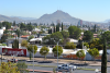
The largest state in Northern Mexico. Chihuahua shares borders with the U.S states of New Mexico and Texas. This state is known for its U.S. border-patrol presence and the Mexican drug cartel trade, which is largely based in Ciudad Juarez. The region’s border location is strategically and diplomatically significant to Mexico, especially after the signing of the 1994 North American Fair Trade Agreement (NAFTA) between the U.S., Mexico, and Canada. NAFTA lifted tax and trade restrictions on much of the trade between these nations, which brought some economic success to Chihuahua. The state has one of the fastest growing economies in Mexico based on its maquiladoras, or factory and assembly plants, which bring a lot of foreign manufacturing business into Mexico, though many of its laborers live in poverty.

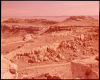
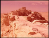
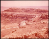
A lot of rural conflict occurred between peasant factions in Chihuahua during the Mexican Revolution (1910-1920). To this day, tourists can visit one of the lead revolutionary figures, Pancho Villa's, mansion. The tourist industry also thrives off of Copper Canyon, a system of canyons larger than the United States’ Grand Canyon, inhabited by the Tarahumara Indigenous tribe and home to many scenic waterfalls. Before Spanish settlement, the geographic region was home to more than 200 Indigenous tribes, many of whom were killed-off over centuries of Spanish colonization. However, many Indigenous peoples still inhabit the area including the Tarahumara, Apache, Comanche, and Guarijio peoples.

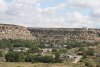
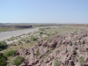
The state's name allegedly comes from the Náhuatl language and means "dry, sandy place." A small breed of dog, the Chihuahua, is named after the region. The Chihuahuan desert is a diverse ecoregion; much of the rocks, and plant and animal life, are distinct to the area. The desert encompasses most of the state and also crosses into parts of Arizona, New Mexico, and Texas.

Little Black Spot Mountain, Arizona

Little Black Spot Mountain (also known as Little Black Spot Mesa), is the peak of a mesa coming off of the larger Black Mesa in the Navajo Nation, Arizona. The mountain is a little over 7,000 feet tall and the closest town is Pinon, Arizona.

Pages

Subscribe to RSS - Geographic Reference