Geographic Reference

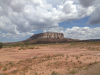
Hopi Reservation, Arizona

The Hopi have lived in the U.S. Southwest for thousands of years, and while their ancestral lands span large swaths of the Southwest, the Hopi Reservation currently covers 1.5 million acres of northeastern Arizona. Within this tract of land there are twelve villages and three mesas. The Hopi Reservation is situated within the Navajo Nation Reservation, a relationship that has caused conflict for over 100 years, as a number of land disputes has resulted in the decrease in size of Hopi land and the creation of a shared Joint-Use territory. While a majority of the Hopi live on three mesas, First, Second, and Third Mesas, there is a Hopi farming community near Tuba City, established in the 1870’s.

Hopi lands first came under control of the U.S. government in 1848 at the end of the Mexican-American War. The war ended with the signing of the Treaty of Guadalupe Hidalgo, where Mexico ceded the southwest, Wyoming, and California to the United States of America. As the Hopi historically avoided interaction with the U.S. government and have always attempted to maintain privacy and sovereignty, the boundary of the Hopi reservation was not determined until 1882. The 1882 U.S. Executive Order-Hopi Indian Reservation originally allotted 2.4 million acres of land to the Hopi. However, this is only a fraction the original 15-million-acre Hopi Tutskwa, or aboriginal Hopi lands. Additionally, when the boundary was drawn, it exclude a large portion of the historic tribal land on which sacred sites, shrines, and villages existed. Later, Hopi reservation land was further reduced in size to 1.5 million acres. The current Hopi tribal lands include the main reservation, the Moenkopi District Reservation, and the Hopi Three Canyon Ranch Lands.

Nokaito Bench, AZ

The Nokaito (also known as Nakaito) bench, which is called Naakaiitó or Mexican Spring in Navajo, is an elevated plain running north and south just to the west of the Chinle Wash in Southern Utah. On the north end it starts just below the San Juan River and runs south past the Arizona state line to the juncture of Walker Creek and Chinle Wash.

Southwest

A region defined in different ways by different sources. Narrowly defined, the core Southwest is centered on the states comprising the Four Corners (Utah, Colorado, New Mexico, and Arizona), with parts of other states making up the beginnings and endings of the Southwest. Most of the Southwest was once part of the Viceroyalty of New Spain. What is now California, Arizona, Nevada, Utah, New Mexico, and portions of Colorado, Wyoming, Oklahoma and Kansas were part of Mexico before the Mexican-American War (1846-1848) and the Gadsden Purchase of 1853.

The Southwest features a semi-arid to arid climate, depending on the location. Much of the region is an arid desert climate, but higher elevations in the mountains feature alpine climates with varying amounts of snow. The term high desert is also synonymous with this region. This area of the desert land generally sits at a very high elevation, much higher than the normal desert land, and can receive very cold temperatures at night in the winter sometimes near zero degrees on very cold nights. Other areas of the Southwest may also be referred to as the high desert, such as the Colorado Plateau.

Sacred Mountain of Blue Flint Woman, Arizona

In Navajo cosmology, there are four sacred mountains that bound the Navajo homeland, each being associated with a specific color and deity. Blue Flint Woman is one of several deities associated with the San Francisco Peaks in northern Arizona. Blue Flint Woman is another name for Abalone Shell Girl, a younger version of Changing Woman, the mother of the Twin Warriors, the youthful heroes of Navajo male coming-of-age stories. Flint, the fire starter, came with the Navajo people as they emerged from the third, or yellow, world into the current world. Mt. Humphreys, the tallest point in the San Francisco Peaks, is traditionally referred to by the Navajo as Doko'oosliid, or Abalone Shell Mountain, the Sacred Mountain of the West, and the color yellow.

The four sacred mountains in Navajo cosmology include:

  • the Sacred Mountain of the East, Mount Blanca (Tsisnaasjini'), Dawn or White Shell Mountain, near Alamosa in San Luis Valley, Colorado.
  • the Sacred Mountain of the South, Mount Taylor (Tsoodzil), Blue Bead or Turquoise Mountain, north of Laguna, New Mexico
  • the Sacred Mountain of the West, San Francisco Peaks (Doko'oosliid), Yellow Abalone Shell Mountain, near Flagstaff, Arizona
  • the Sacred Mountain of the North, Mount Hesperus (Dibé Nitsaa), Big Mountain Sheep, Obsidian Mountain, near the La Plata Mountains, Colorado.

Black Rock BIA Hospital, New Mexico

Formerly known as Ranchos de Zuni, Black Rock is currently an incorporated extension of Zuni Pueblo. Its name derives from its location on the south side of the Zuni River, the side with the broken lava flow also known as malpais, or bad country, in Spanish. Today, the public health care center located in Black Rock is known as the Zuni Comperehensive Community Health Center, managed by federal Indian Healthcare Service under the auspices of the Bureau of Indian Affairs (BIA); there is also the Zuni Health Initiative nearby. Zuni Indian Hosptial is located just down the road in Zuni Pueblo proper.

Corona, New Mexico

A village near the base of the Oscura Mountains located in Lincoln, New Mexico along U.S. Route 54. The area of Corona was initially settled by Spanish sheep and cattle ranchers. The community was not incorporated as a town until 1903, when a stop for the South Western Railroad was created.

Hall, New Mexico

A fictitious town near the Oscura Mountains in Socorro County in central New Mexico. A small community mentioned in Tony Hillerman's 1970 Navajo detective novel THE BLESSING WAY, Hall is a town close to the home of the novel's antagonist Jim W. Hall. The Oscura Mountains happen to be at the north end of White Sands Missile Range and are also the site of an Air Force Research Laboratory, an interesting tie-in to the novel's plot.

Toh-Chin-Lini Butte, Arizona

A butte, or stand-alone mesa, located in Apache County in northeastern Arizona, which shares the same name with a nearby canyon. In Navajo, toh-chin-lini means “water flowing out.” Located near Black Rock Point and along the west slope of the Carrizo Mountains, this mesa is also known as Ceniza Mesa.

Seklagaidesi, Arizona

Also known as Seklagidsa or Tselagideza Canyon, located in the western slopes of the Carrizo Mountains in Apache County, Arizona. There is also a canyon by the same name nearby. In Navajo, Tselagideza means “Prominent White Cliffs." The head of Walker Creek begins in this canyon and further down it joins with Alcove Canyon.

Cortez, Colorado

A city in southern Colorado located along the Dolores River. This city was named after the Spanish conquistador Hernán Cortés, who conquered the Aztecs in Mexico. Many places in this area, including Montezuma Valley, Montezuma County, and Cortez itself, are named after people associated with the Aztecs, because the region was originally thought to have been inhabited by the Aztecs rather than the Ancestral Puebloans.

This city is the seat of Montezuma County. The modern city was founded in 1886 by the Montezuma Valley Company, who built a canal running from the Dolores River into the town to provide water for irrigation and livestock. Prior to modern settlement this area was inhabited by the Ancestral Puebloans, Ute, Arapaho, and the Navajo.

Pages

Subscribe to RSS - Geographic Reference