Geographic Reference

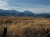
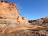
Sandia Crest, New Mexico

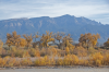
Sandia Crest is the highest peak in the Sandia Mountain Range with an elevation of 10,678 ft. The Sandia Mountains are located east of the city of Albuquerque, New Mexico. This range is located within the Cibola National Forest and is composed of granite and limestone. The Sandia Crest is located on the western side of the range. Although the crest is populated with a large array of communications towers, the longest aerial tramway in the world carries visitors from the valley floor to a lodge and restaurant on the crest, providing them with extraordinary views along the way and as they take advantage of refreshments at the top.

Nevada Plateau

A large plateau located in the northern quadrant of Nevada, approximately 60 miles from the eastern border between Nevada and Utah. The East Humboldt Range is a mountain range near the center of the Nevada Plateau. The topographic relief is characterized by mountains and valleys that dissect the plateau. These mountain ranges are strikingly similar geologically, with long ranges intersected by peaks at fairly regular distances.

Tsay-Begi, Arizona

Tsay-Begi, also known as Tse' Biyi, is an area located in Navajo County, Arizona. Tsé Biiʼ is a Navajo place name, which translates into English as "Rock Canyon." Tsé Biiʼ is a broad, sandy plain that lays east of Wetherill Mesa and northeast of Mitchell Mesa within Monument Valley Navajo Tribal Park, also known as Tsé Biiʼ Ndzisgaii in Navajo.

Sherman, Texas

A small town in north-central Texas that was founded in 1846. The town is named after General Sidney Sherman, a leader of the Texas Revolution of 1835, during which Anglo settlers in northern Mexico attempted to secede from the Mexican nation. Sherman was established as the county seat of Grayson County and developed as a center for commerce, services, and industry.

Saigon, Vietnam

Vietnam is a country located in Southeast Asia and is bordered by China, Laos, and Cambodia. From 1859-1954 the country was colonized by the French government, and before the Vietnam War (1954-1975), Vietnam's capital city was known as Saigon. Saigon remained the capital of South Vietnam when the country divided as a result of the civil war that found the Cold War powers of China and the U.S. entering the fray to battle for Vietnam's strategic location. By April 20, 1975, Saigon was captured by the Communist North Vietnamese army. It was at this point that the city was renamed Ho Chi Minh City after the founder of the Indochina Communist Party, President, and Prime Minister of the Socialist Republic of Vietnam. Even though the city's name officially remains Ho Chi Minh, it is still referred to colloquially as Saigon.

Camp Pendleton, California

The primary Marine Corps base on the West Coast, located in San Diego, California. It was established in 1942 during World War II. This base was named after Major General Joseph Henry Pendleton and was originally built to be a temporary facility, but by the end of the war had been designated a permanent installation.

Chinle Sub-agency, Chinle, Arizona

The Navajo Nation is split into seven districts, each with a field station: Window Rock, Arizona (1), Shiprock, New Mexico (2), Crownpoint, New Mexico (3), Tuba City, Arizona (4), Chinle, Arizona (5), Kayenta, Arizona (6), and Dilkon, Arizona (7). The Chinle sub-agency is the fifth district and was founded after 1901. In 1949 when Window Rock was made into the main agency the Chinle agency was demoted to a sub-agency.

Hard Goods Canyon, Arizona

Hard Goods Canyon is a fictional canyon in Tony Hillerman’s first Navajo detective novel THE BLESSING WAY, published in 1970. The canyon is located near Old Woman Gray Rock’s summer brush hogan. According to the text of THE BLESSING WAY, Hard Goods canyon is located nine miles north of Many Ruins Canyon, which is part of Chinle Wash near Dinnehotso in northeastern Arizona.

Greasewood, Arizona

Greasewood is a small, predominantly Navajo community in northeastern Arizona. The community boasts the Lower Greasewood Chapter House, and the children in Greasewood are served by the schools of the nearby communities of Holbrook, Indian Wells, and Ganado. The name Greasewood likely refers to a bush, also known as creosote, which is known for its astringent odor, especially when wet or burning. For many desert dwellers, the scent of wet creosote bush is a scent associated with the summer monsoons, a welcome perfume that can almost overwhelm the senses on a humid afternoon.

Window Rock Navajo Police Department

Located in the southern portion of the Navajo Nation Reservation, Window Rock Police Department serves as the headquarters for the Department of Public Safety of the Navajo Nation. Window Rock is located in the Navajo Nation's District 1 and is commanded either by a Police Captain or Lieutenant, who ensures that the district is run properly, including criminal investigations, area patrol, and public services support. Additionally, in Tony Hillerman's Navajo detective series, Window Rock is the station to which Joe Leaphorn is assigned.

Throughout Hillerman's novels, "Window Rock" is used metonymically to refer to the Navajo Nation Police headquarters.

Pages

Subscribe to RSS - Geographic Reference