Geographic Reference

Caribbean

A group of islands off the southeast coast of North America, due east of Central America, and due north of South America. Located in the Caribbean Sea, these islands are geographically considered part of North America. The name Caribbean refers to the Caribs, the original inhabitants of the islands, who were wiped out by genocidal practices that paved the way for the first iterations of sugarcane slavery plantations, which began as early as the 1500s. Today, the islands of the Caribbean represent one of the richest cultural diasporas to emerge from colonial subjugation.

White Sands Proving Grounds, New Mexico

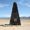
An area in New Mexico used by the U.S. Army for rocket testing, White Sands is part of the largest military complex in the U.S., one which includes Holloman Air Force Base as well as the McGregor Range Complex at Fort Bliss. In 1945, this missile range was the location of the first test of a nuclear warhead, the scar of which is known as the Trinity Site. The proving grounds and associated military base are known as White Sands, because the base is located on a vast dune field located near the San Andres Mountains in southern New Mexico.

Tonepah Range, Nevada

More commonly spelled Tonopah, the Tonepah missile proving range is found in southcentral Nevada, where it is also utilized by the Department of Energy for various governmental research and development programs.

Erratum: In Tony Hillerman's 1970 Navajo detective novel THE BLESSING WAY, the novel's protagonist notes that the Tonepah missile testing range is in Utah; however, the testing range is in fact in Nevada.

Mormon Ridge, Arizona

A south-southeast trending ridge near the edge of the Kaibab Plateau in northern Arizona. This ridge is north of Crooked Ridge and northeast of Echo Cliffs and is located in the Little Colorado River watershed.

There is also a Mormon Ridge Trail located in southeastern Arizona, near Sunizona and Coronado National Forest.

Ganado, Arizona

A settlement in Apache County, Arizona. The settlement is named after Ganado Mucho, the last head chief of the western division of the Navajo and the twelfth signer of the U.S.-Navajo Treaty of 1868, which guaranteed to the Navajo their right to return to and remain on their homeland after their forced Long Walk to and incarceration at Bosque Redondo in southeastern New Mexico in 1864.

Ganado is also home to the Hubbell Trading Post National Historic Site, a long-time institution on the Navajo Nation reservation.

Biz-E-Ahi Wash, Arizona

Also written as Bis'ii ah Wash, Biz-E-Ahi Wash is a tributary of the Nazlini wash in Apache County, Arizona. In Navajo, Bis'ii ah means “standing adobe formation." Biz-E-Ahi Wash is located on the western foot of the Defiance Plateau and then flows south along both the Ganado Mesa and the perimeter of Beautiful Valley until it merges with Nazlini wash. This wash lays five miles south of the community of Nazlini.

Sabito Wash, Arizona

Sabito Wash is a 20-mile-long tributary of Leroux wash located within the Painted Desert in northeastern Arizona. This wash is on the northern boundary of Petrified Forest National Park. In Tony Hillerman's 1970 novel, The Blessing Way, Sabito Wash marks the region that character Luis Horseman is from.

Colorado River

This is the largest river in the Southwestern United States, and its headwaters are located in the state of Colorado at La Poudre Pass Lake. The Colorado runs through the U.S. states of Colorado, Utah, Arizona, and Nevada before crossing into Mexico on its way to Baja California. The Navajo name for the river is Nts’ósíkooh, meaning “Slim Water Canyon.” The Colorado River is considered female by the Navajo, and the location where the Colorado River is “mounted” by the (male) San Juan River, at what is now Lake Powell, is sacred to the Navajo.