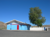
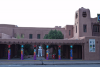
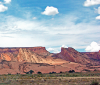
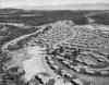
Geographic Reference

Tuba City, Arizona

Tuba City is located in Coconino County, Arizona on the southern edge of the Kaibito Plateau. This town is one of the largest communities on the Navajo Reservation but it also has a small Hopi population. During the 1870s, Mormons briefly resided in Tuba City. At that time, Mormons named the community after a Hopi headman named Tuvi, who converted to Mormonism. Mormons later sold the town, which they claimed to be their property, to the U.S. Indian Service (in later years known as the Bureau of Indian Affairs). Mormons had been encountering increasing levels of antagonism from the Navajo, the original inhabitants of the area, which may explain why the Mormons sold the town and left the area.

One Navajo word for Tuba City is Tö Naneesdizí, which means “Place of Water Rivulets,” referring to the irrigation ditches used by Mormons during their occupation.

Teec Nos Pos, Arizona

Teec Nos Pos is a small community located six miles southeast of the Four Corners Monument in Apache County, Arizona. Teec Nos Pos has shifted north from its original location, closer to the Junction of U.S. Highway 160 and 64. The community is composed of a trading post, a chapter house, and a school. The Navajo name for this community is T’iis Názbad which means “cottonwoods in a circle.”

Santa Fe, New Mexico

The state capital of New Mexico, Santa Fe (meaning “holy Faith” in Spanish) is the oldest capital in the United States. At an elevation of over 7000 feet, it is also the highest one. The city was founded in 1610 by Don Pedro de Peralta as the capital of the province of New Mexico under colonial Spanish rule. The lands surrounding the town were occupied by indigenous peoples for centuries before the arrival of the Spaniards, and in fact today’s downtown area sits atop at least two Pueblo ruins.

The city remained small and fairly provincial through the transition from Spanish, to Mexican, and then American rule, but in the early 20th century it established itself as a cultural hub that celebrated a mix of indigenous histories, Hispanic traditions, and modern American influences. The community of artists and writers who were attracted to the area, the most famous of which is the painter Georgia O’Keefe, contributed greatly to the city’s growth and development as a tourist destination.

Santa Fe’s economy has come to rely heavily of tourism, promoting a romantic, somewhat exotic image of a small city that boasts numerous attractions such as museums and art galleries, a historic plaza at the heart of downtown, old churches, Pueblo architecture, and high-end boutiques and restaurants. The upscale attractions, along with the area’s natural beauty, have attracted a wealthy population that has gradually displaced many of the city’s original residents. Today Santa Fe stands in stark contrast to the neighboring small towns and even the bigger city of Albuquerque, communities that struggle with stunted economic development and a lack of resources.

Sangre de Cristo Mountains, Colorado & New Mexico

One of the longest mountain ranges in the world. The range begins at Poncha Pass in Colorado and extends 204 miles south to Glorieta Pass near Santa Fe, New Mexico. The Spanish explorer Antonio Valverde y Cosio named the mountain range “Blood of Christ” in Spanish, remarking on its red color at sunrise. Blanca Peak is the highest point of the range, reaching over 14,000 feet. The headstreams of the Pecos and Canadian rivers begin in the mountain range. The range is a part of San Isabel, Rio Grande, Carson, and Santa Fe national forests and includes a number of national monuments. The mountains are popular among tourists and have also been exploited by the mining industry.

Oklahoma

Oklahoma is a Choctaw Indian word that means “red people” and is derived from the words for people (okla) and red (humma). Currently, 39 individual tribes have their headquarters in Oklahoma including the Apaches, the Cherokee Nation, the Comanche Nation, the Kiowa, and the Seminoles, many of whose original homelands are long distances from this region. In 1803, the land that became Oklahoma was added to the U.S. as part of the Louisiana Purchase. Before statehood, these lands were used as relocation territory under Indian Removal Act, 30 tribes were relocated, and the region became known as "Indian territory." After statehood in 1907, the U.S. government recaptured the territories previously assigned to relocated indigenous groups. Oklahoma is a major producer of natural gas, oil, and agricultural goods for the rest of the United States. In 1995, Oklahoma City, the state capital and most populated city in the state was the site of a fatal domestic terrorist act orchestrated by Timothy McVeigh and Terry Nichols. The Oklahoma City bombings made international news when 168 people were killed and 680 others wounded at the Alfred P. Murrah Federal Building.

Monument Valley Navajo Tribal Park, Utah

Monument Valley Navajo Tribal Park, called Tse'Bii'Ndzisgaii in Navajo, is a Tribal Park located within the Navajo Reservation on the Arizona-Utah border near the Four Corners area. The park covers an area of the Colorado Plateau featuring clusters of immense sandstone buttes that tower over the landscape at heights reaching from 400 to 1,000 feet. A sacred area to various indigenous groups, Monument Valley's impressive geological formations, isolated mesas, and sandstone pillars have also been used extensively as scenery in movies, commercials, and music videos since the 1930s, becoming the iconic representation of the Southwest.

Moab, Utah

A small town known for its access to some of the most popular hiking, mountain biking, and rafting areas in the Southwestern U.S. including Canyonlands and Arches National Parks. Moab's service industry thrives as it caters to a wide range of outdoor and cultural enthusiasts. Originally inhabited by the Ute people, Moab is the anglicized version of the Paiute word for mosquito, “moapa.” Settlers to Moab have included Mormon missionaries, the U.S. military, and railroad workers. Japanese-Americans were interned in Moab during World War II.

Mexico

Mexico is a federal republic that borders the United States to the south. The Mexican states of Baja California, Sonora, Chihuahua, and Coahuila de Zaragoza share direct borders with the southwestern and western states of California, Arizona, New Mexico, and Texas (respectively from west to east). Spaniards conquered and colonized the region beginning in the early 1500s. The national spoken language is Spanish, and the country boasts the largest population of Spanish speakers in the world. However, many tribal groups still exist and thrive in Mexico. Mexico was home to several very advanced Amerindian cultures including the Olmec, Toltec, Zapotec, Maya, and Aztec.

Mexican Water, Arizona

A small community on the Navajo Nation Reservation off of US Highway 160 at a steep rocky crossing of Chinle Wash near Dinnehotso. Mexican Water has a trading post and a chapter house. The region is very rocky, and, before the paving of the highways that run nearby, the only location markers were piles of rocks.

Los Alamos, New Mexico

Los Alamos is a town in New Mexico made up of the townsite of Los Alamos proper and the smaller community of White Rock. The town is built atop four mesas and White Rock Canyon in a scenic, mountainous area. The town features recreational activities for tourists and visitors including skiing, hiking, and biking trails. Bandelier National monument is accessible from Los Alamos. The town was home to the Los Alamos Ranch School for Boys, which ran from 1918-1943.

Los Alamos is home to one of the two national laboratories in the United States where top secret work on nuclear weapons takes place. The laboratory also conducts research on solar and nuclear energy. In 1943, the laboratory was built as part of the Manhattan Project for the specific purpose of designing a functioning atomic bomb. In 1945, the bomb was successfully tested in southern New Mexico at the Trinity Site. In 1945, the U.S. dropped nuclear bombs on Hiroshima and Nagasaki, Japan killing approximately 129,000 people. The laboratory was also the first to develop a hydrogen bomb. Los Alamos has one of the highest per capita rates of PhDs, and highest median incomes, of any county in the U.S. This laboratory, and New Mexico more generally, have a reputation for nuclear and uranium testing, which has been controversial across the United States. Much of the radioactive testing and building happens on or near reservation land, and what many tribes of Native Americans consider to be sacred land.

Pages

Subscribe to RSS - Geographic Reference