Geographic Reference

Dinnehotso, AZ

A small community on the Navajo Reservation, located on Highway 160 in the northeastern corner of Arizona. In Navajo, the name Dennihotso means "A Yellow Meadow Extending Upward." The place was a summer camp site for some Navajo families, and between 1911 and 1915 a trading post was established in the village, which allowed for a more permanent settlement to grow around it. Small-scale farming was the main source of livelihood for Dennihotso families, and between 1940 and 1960 Uranium mining in the nearby Cane Valley provided employment as well, but after the decline of the mining industry the town experienced a significant depression. Today the trading post is closed, and many farms are idle as younger generations migrate to bigger towns in search of employment and a more modern lifestyle. According to the 2000 census the community's population was 734.

Zuni Buttes, New Mexico

Buttes are similar to mesas in that they are flat-topped hills with steep sides, although they are much smaller than mesas, and tend to stand out as isolated landscape features. The Zuni Buttes are a group of such rock formations located in the northwestern corner of the Zuni Pueblo Reservation in western New Mexico.

Red Lake Trading Post, Arizona

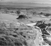
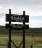
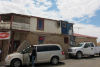
Referred to simply as Red Lake in Hillerman's fiction, this small trading post and rest area off of US Highway 160 (referred to in the book by its former name, Navajo Route 1) sits below the rim of Black Mesa. It should not be confused with the actual body of water, Red Lake, to the east, on the Arizona-New Mexico border. The Trading Post was founded around 1878 in a town that is now known as Tonalea. The post is well known for its Navajo rugs.

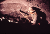
A trading post is an establishment where goods can be traded. It is also a social center where news and gossip are exchanged. Trading posts have been associated with American frontier culture since seventeenth century. Overtime, trading posts developed into a cultural institution, at first funded and backed by empire, later by national interests, and most often by enterprising business men. Trading posts became centralized hubs in a network of exchange that both participated in and circumvented the burgeoning capitalist system that was imported into the Americas along with settler colonialism. Although trading posts were initially intended to provide support to the European traders and trappers who traced their way over the North American continent, Native American groups were also drawn into the posts' exchange network, trading furs, pelts, and even scalps for finished goods such as steel knives, firearms, woven textiles, and food stuffs, including alcohol. Although not every post was poorly managed, trading posts earned a nefarious reputation for taking advantage of Native traders, by offering poor exchange rates, trading with products that were infected with diseases, and promoting the purchase and use of alcohol. Many trading posts are still in existence, and in the Southwest, they still mark "the frontier," as they are located, as they have been for centuries, at the dividing line between wilderness, Indian country, and reservation lands, on the one hand, and settled, ordered, and contained "civilization," on the other hand. Today, however, trading posts can be reached by pickup truck, tourist RV, and even the occasional horse. Many trading posts are also preserved as National Historic Sites.

Rio Grande River, Colorado, New Mexico & Texas

The Rio Grande is a large, meandering river that flows north to south from its headwaters in the San Juan Mountains in southwestern Colorado through the center of New Mexico. This river serves as the southwestern border between the U.S. state of Texas and Mexico and eventually empties into the Gulf of Mexico. Rio Grande means “Big River” in Spanish and is alternatively known as Rio Grande del Norte meaning “Great River of the North.” South of the U.S./Mexico border the river is called the Rio Bravo.

Rio Bravo Boulevard, Albuquerque, New Mexico

A relatively old, major street in Albuquerque, New Mexico. The street runs east-west through Albuquerque's old farming neighborhoods of the South Valley. It starts in the east at the intersection of Interstate 25, crosses the Rio Grande River, and officially ends at Coors Boulevard in the west, at which point its name changes to Dennis Chaves Boulevard, a road that continues further into the southwestern outskirts of the city, ending in the junction with Atrisco Vista Boulevard. The name Rio Bravo is the Mexican name for the Rio Grande River, which runs through the state of New Mexico, including the city of Albuquerque, and into the Gulf of Mexico. In Spanish, "grande" means big and "bravo" means brave or fierce.

Jicarilla Apache Reservation, New Mexico

The Jicarilla Apache are one of nine Apachean speaking tribes, and their name means “Little Basket.” The Jicarilla Apache Reservation is located in northern New Mexico, and the headquarters for the reservation is located in Dulce, New Mexico. The reservation was established in 1887 by an Executive Order given by United States President Grover Cleveland. In 1937, they adopted a formal style of government and a constitution. They have a tribal council and their government includes three branches: executive, legislative, and judicial.

Reno, Nevada

A city located in the northwestern part of the state of Nevada, very near the border with California, just east of the Sierra Nevada Mountains. Reno was established as a gold and silver mining community in the late 1800s and grew gradually until the 1930s, when Nevada legalized gambling. Reno became known for its many casinos, which offered a popular destination for tourists and gamblers from neighboring states.

Red Deuce, New Mexico

In his mystery novel People of Darkness (1980), Tony Hillerman refers to the Red Deuce Mine as the location of a fatal explosion that killed many local workers. There is no indication that such a place existed. Hillerman may have invented the name to avoid direct reference to specific uranium production companies that had been operating in the area since the 1950s. Red Deuce might be the fictional version of the Red Bluff mine, a real location near Grants, New Mexico.

Ramah, New Mexico

Originally settled by Mormon pioneers, who intended to perform missionary work in Zuni and Navajo communities, Ramah sits between the Zuni and Ramah Navajo Reservations. The town was initially intended to be both a spiritual and agricultural center. It currently provides direct access to the Cibola National Forest, El Morro and El Malpais National Monuments, a wolf sanctuary, and a seasonal farmer's market with close ties to the town's original pastoral inhabitants.

Rainbow Plateau, Arizona & Utah

A broad expanse of canyonlands inclusive of much of the Colorado Plateau and the Mogollon Rim, the Rainbow Plateau covers territory in the Navajo Nation, Arizona, and Utah. Comparable in scale to the Tibetan Plateau, the Rainbow Plateau is one of the largest canyon lands in the world, as well as one of the most colorful. Some of the well-known sites on the plateau include the Painted Desert, the Grand Canyon, the Vermillion Cliffs, Rainbow Bridge National Monument, and Chaco Canyon.

Pages

Subscribe to RSS - Geographic Reference